


Nature » Unanimated nature » Relief
Relief
The connection of the particular mountain ranges by the summits lines shows the mountain ridges system (NW – SE), diagonal to the uplift of the Beskid Niski rampart and accordant to the direction of the Magura Unit folds. It is proved by the land exposure in the area of the Park.
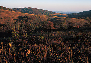
Ciechania (phot. Stefan Michalik)
The map of the land exposure of the Magura National Park shows that the eastern and north-eastern exposures dominate in the Park, covering respectively 18.3 % and 17.35 % of the area. Slopes of the southern and northern exposure are very rare (8.06 % and 10.28 % respectively), the north-western exposure covers 10.42 % and western – 12.98 % of the area.
A characteristic feature of the relief is inversion, which means that the heights are built of the resistant syncline bedrocks or syncline limbs (Magura sandstones), while the lows were formed of less-resistant rock (shales) separating the synclines and exposing in anticlines.
While analysing the map of land slope it may be noticed that the Magura National Park does not abound with lands of high slope (above 25°). Two divisions of slopes dominate in the Park: 6° - 10° and 11° - 15°, covering respectively 30.53 % and 33.27 % of the area. The smallest slopes (0° - 5°) can be found in the Wisloka valley and on the spots of large tributaries’ mouths.
The moderate insolation conditions dominate in the Park. The majority of the area (about 85 %) gets the insolation of a value of 95 % - 115 % during a year. The extreme classes – first and sixth – cover below 1% of the Park’s territory.
« prev | page 2 of 2